Thursday 7 October 2010

Following the Cromford Canal ~ 3

The third walk along the Cromford Canal as I  progress away from Cromford itself.

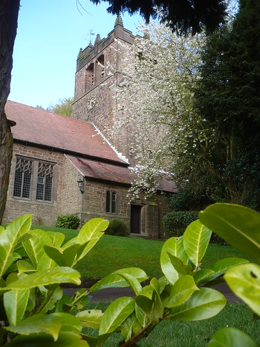
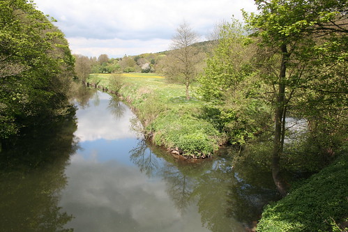
I parked next to The Birches at Ambergate and crossed the River Derwent ...

Cromford Canal III ~ 9th May 2010

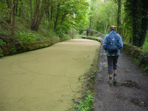
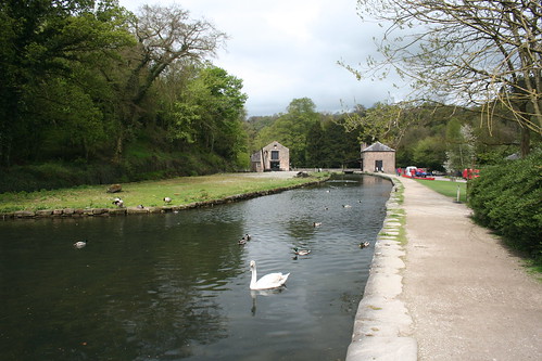
I passed the cricket pitch and the Hurt Arms before turning up Chase Road to cross the canal. On the far side of the canal is this well ...

Cromford Canal III ~ 9th May 2010

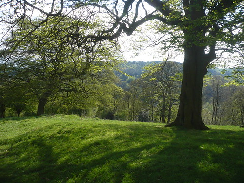
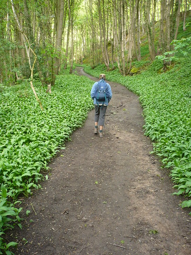
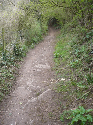
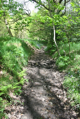
A few hundred yards later and I was walking up through Crich Chase with the sun coming through the leaves overhead ...

Cromford Canal III ~ 9th May 2010

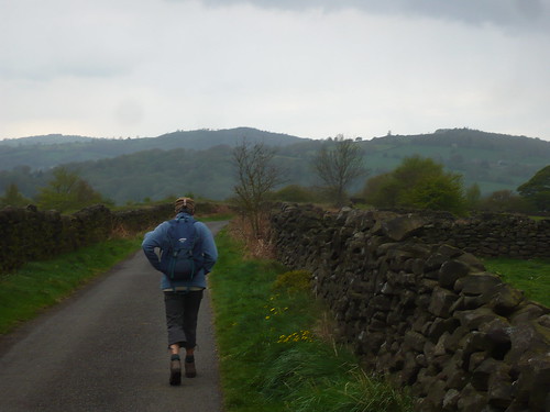
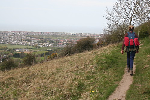
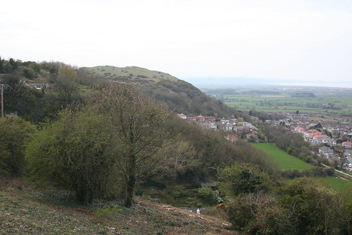
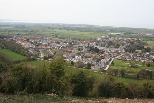
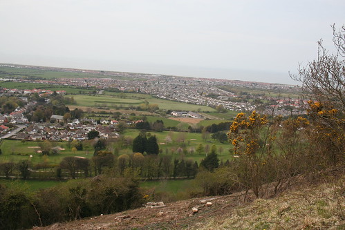
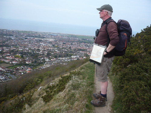
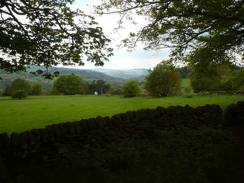
I climbed the hill out of the valley and came out on the path to the west of Chadwick Nick, Crich. Turning left I entered the small woodland beside the road and followed the path through the wood. There's a good view from here away towards Masson Hill above Matlock ...

Cromford Canal III ~ 9th May 2010

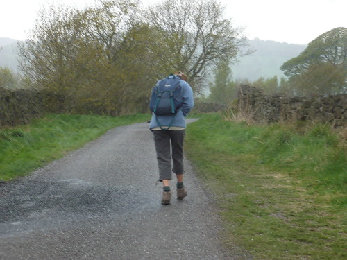
Walking down the lane towards Whatstandwell I noticed an old milestone which  is one of the roadside features that we ignore or take for granted ....

Cromford Canal III ~ 9th May 2010

I find them fascinating, what with their quaint lettering and misspellings ~ doesn't the one above read 'ASHBOURE' rather than 'ASHBOURNE' ?

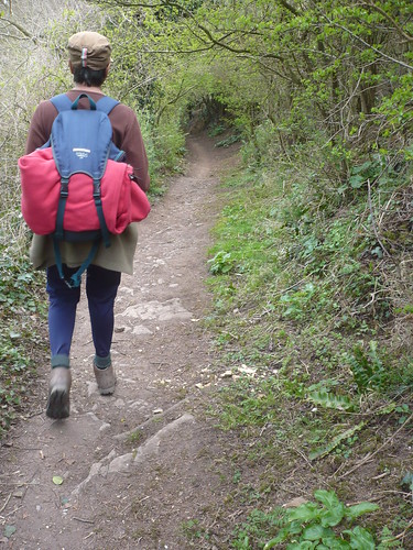
Rather than go all the way down to the A6 and pick up the canal, I wandered along some of the more obscure paths of Whatstandwell and ended up in the wood on the east side of the Whatstandwell/Holloway road ...

Cromford Canal III ~ 9th May 2010

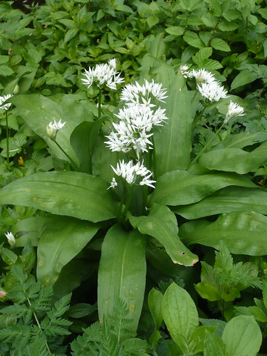
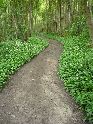
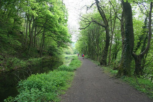
Then I was nearly down to the canal near Robin Hood and looking along the path we'd walked a few days ago ... and still the wild garlic wasn't in full bloom !

Cromford Canal III ~ 9th May 2010

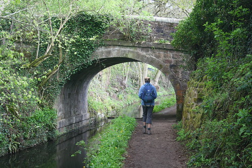
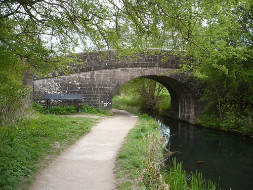
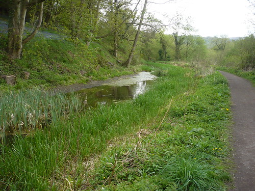
Then I was down by the canal and continuing along my journey, initially towards Whatstandwell bridge ...

Cromford Canal III ~ 9th May 2010

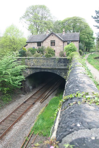
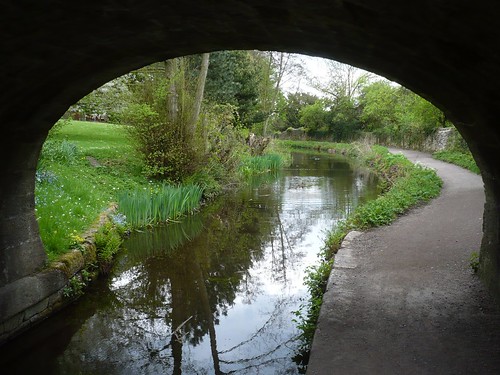
I passed under the bridge and noticed the water level was quite low.

Cromford Canal III ~ 9th May 2010

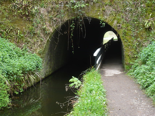
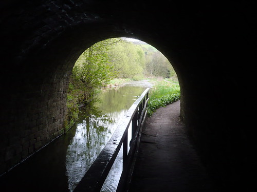
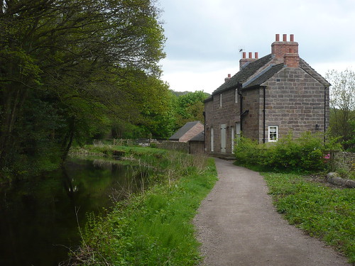
The unusual thing about the house on the right in the photo above is that it is built above a tunnel ...

Cromford Canal III ~ 9th May 2010

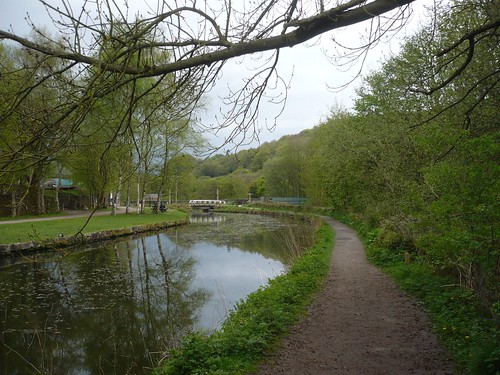
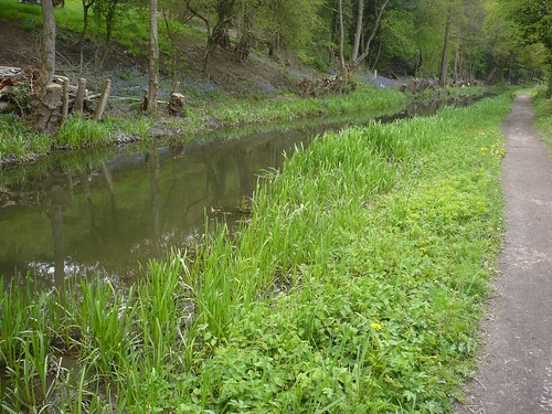
Further along the canal some clearance work had been done on the far side of the canal and the bluebells were in flower ...

Cromford Canal III ~ 9th May 2010

Cromford Canal III ~ 9th May 2010

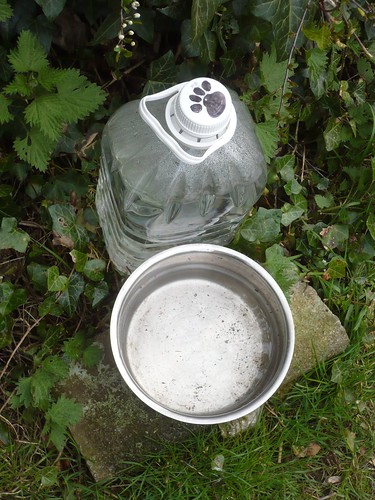
There were some small wooden 'rafts' floating on the water ...

Cromford Canal III ~ 9th May 2010

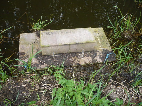
... and close inspection revealed what they were.

Cromford Canal III ~ 9th May 2010

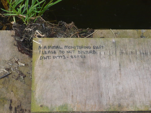
'DWT' stands for 'Derbyshire Wildlife Trust'.

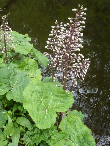
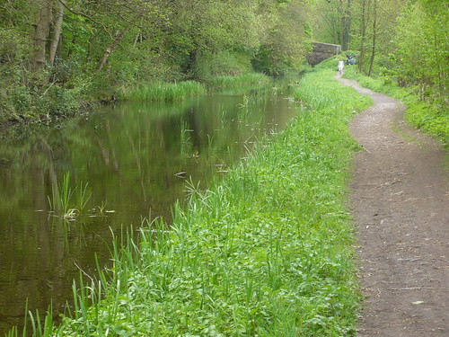
The greenery was lush and plentiful ...

Cromford Canal III ~ 9th May 2010

... and by now I was getting nearer to Ambergate ...

Cromford Canal III ~ 9th May 2010

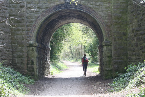
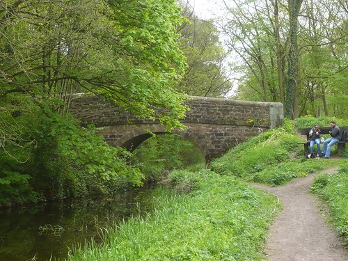
Earlier in the day I had walked over the bridge I now went under ...

Cromford Canal III ~ 9th May 2010

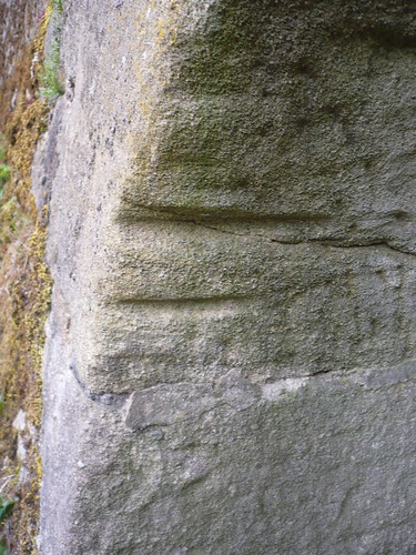
I assume the marks under the bridge were where the rope of the horse walking along the towpath slowly rubbed into the stone ...

Cromford Canal III ~ 9th May 2010

Then I walked under a rather rusty old bridge ...

Cromford Canal III ~ 9th May 2010

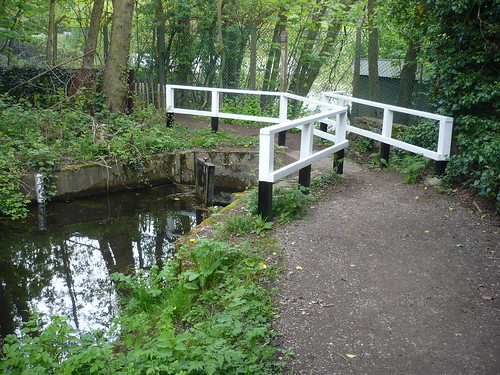
... to reach the end of the canal, at least at this point ...

Cromford Canal III ~ 9th May 2010

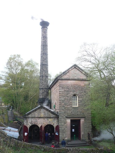
The canal used to run through here but now there is, or at least there was, some large 'gas' buildings ... but more of that another day.

All that remained was for me to backtrack at this point all the way back to the car.
You can see the route I followed on the OS Explore website, here :~ http://explore.ordnancesurvey.co.uk/os_routes/show/19674

Date of walk ~ 9th May 2010

Length of walk ~ 6 miles

Total walked so far in 2010 ~ 135 miles

Total walked since 1st September 2009 ~ 265 miles

25 of 2010

Monday 27 September 2010

Following the Cromford Canal ~ 2

You're probably wondering why start the second section of my walk with a photo of a rhododendron. Well, we parked near to Lea Rhododendron Gardens and even from the road there were plenty of beautiful flowers to see ...

Holloway and the Cromford Canal ~ 3rd May 2010

We walked down the path on the northern side of the gardens where the overhanging rhodies meant we had to keep our heads low ...
   
Holloway and the Cromford Canal ~ 3rd May 2010

We got down to the main road running through Holloway and passed the church ...

Holloway and the Cromford Canal ~ 3rd May 2010

I don't know that I have ever walked all the way along the main street of Holloway, past Little London and the art gallery. Then we passed the Yew Tree pub, closed for a few years now. We descended the path with Lea Hurst, Florence Nightingale's Derbyshire home, away to our right and with the canal, out of sight, in the valley below ...

Holloway and the Cromford Canal ~ 3rd May 2010

On reaching the canal at Gregory Tunnel we turned left and headed towards Whatstandwell, passing the handful of properties known as Robin Hood ...

Holloway and the Cromford Canal ~ 3rd May 2010

Why Robin Hood I always ask myself.

We continued with the canal alongside us, on our left ...

Holloway and the Cromford Canal ~ 3rd May 2010

Holloway and the Cromford Canal ~ 3rd May 2010

Holloway and the Cromford Canal ~ 3rd May 2010

The canal, in the photo immediately above, looks strange because the surface of the water was covered in thousands and thousands of tiny leaves.

After just a couple of miles [if that] we had to leave the canal to get back to Long Lane, Lea. We were just a few days too early to see the wild garlic in flower.

Holloway and the Cromford Canal ~ 3rd May 2010

Holloway and the Cromford Canal ~ 3rd May 2010

When we reached Wakebridge we walked along the edge of the valley looking down at the views. We got onto Long Lane, the lane leading to the Rhododendron Gardens. There were dark clouds overhead ...

Holloway and the Cromford Canal ~ 3rd May 2010

... and then we were in the middle of a hailstorm ...

Holloway and the Cromford Canal ~ 3rd May 2010

and the hailstones hurt.

Good walk though.

You can see the route I followed on the OS Explore website, here :~ http://explore.ordnancesurvey.co.uk/os_routes/show/19674

Date of walk ~ 3rd May 2010

Length of walk ~ 4 1/4 miles

Total walked so far in 2010 ~ 129 miles

Total walked since 1st September 2009 ~ 259 miles

24 of 2010

Monday 20 September 2010

Following the Cromford Canal ~ 1

I have decided to walk the whole of the Cromford Canal ... or what remains of it as it is disused and unusable in some parts. The first few miles are fine though ...

Starting at Cromford Wharf car park [where a fee is payble] there's a tearoom here and toilets ...

Cromford Canal I ~ 2nd May 2010

... and some of the original buildings ...

Cromford Canal I ~ 2nd May 2010

 Within, what, half a mile of the start of the canal there's an attractive stone bridge where some of my schoolfriends used to miss out a lap during cross country runs ...

Cromford Canal I ~ 2nd May 2010

I could name names ...

These photographs were taken right at the beginning of May and the leaves still have that springtime freshness ...

Cromford Canal I ~ 2nd May 2010

I reached the buildngs of High Peak Junction but unfortunately some of them were shrouded in sheeting but looking back you can see how quiet the canal was that day ...

Cromford Canal I ~ 2nd May 2010

 I reached Leawood Pump House which still works and which opens so many weekends a year.

Cromford Canal I ~ 2nd May 2010

There's plenty of information about it, here ... http://www.middleton-leawood.org.uk/

I'm being lazy, I know. However, I can confirm it is an interesting place to visit, though I would hate to keep all the machinery clean and polished.

Cromford Canal I ~ 2nd May 2010

Just beyond the pump house the Nightingale arm of the canal runs away towards John Smedley's factory. Just beyond the junction of the Nightingale arm and the canal proper there are signs of the canal getting silted up ...

Cromford Canal I ~ 2nd May 2010

 In the photo above you can see the bluebells in Lea Wood. On my side of the canal other plants were in flower, such as wild garlic ...

Cromford Canal I ~ 2nd May 2010

and butterbur ...

Cromford Canal I ~ 2nd May 2010

 As I came to Gregory Tunnel I spotted a long tailed tit's nest in a bramble at head height right beside the canal. I have a photograph but it's not a good one. It seemed strange that the nest had been built just literally out of arm's reach in such a busy place. Perhaps when the leaves came out a bit more then the nest wouldn't be so visible.

I walked through the tunnel ...

Cromford Canal I ~ 2nd May 2010

Cromford Canal I ~ 2nd May 2010

Primroses were out too ...

Cromford Canal I ~ 2nd May 2010

 I left the canal at the tunnel and crossed the River Derwent and passed under the railway line to come out on the A6 at Homesford Cottage. The pub there has now closed and I dare say it will never open again ...

Just beyond the pub I turned sharp left up a path that rises towards Longway Bank and from there [using a concessionary path in the wood] I reached Intake Lane.

It was thereabouts that I spotted a Midshires Way waymark ...

Cromford Canal I ~ 2nd May 2010

Intake Lane passes under the High Peak Trail on the edge of Cromford village ...

Cromford Canal I ~ 2nd May 2010

From there I descended into the village, crossed the A6 and got back to my car.
You can see the route I followed on the OS Explore website, here :~ http://explore.ordnancesurvey.co.uk/os_routes/show/19521

Date of walk ~ 2nd May 2010

Length of walk ~ 5 1/2 miles

Total walked so far in 2010 ~ 124.75 miles

Total walked since 1st September 2009 ~ 254.75 miles

23 of 2010

Monday 30 August 2010

They think it's all over ... it is now !

or, finishing off Offa's walk ~ Day 6

On this day of days, Natasha and I travelled north to the Irish Sea. Parking the car near the seafront we turned inland away from the sea to find the Prestatyn-Dyserth Way ... and headed south.
 
Finishing the Offa's Dyke Path ~ April 2010

The Prestatyn-Dyserth Way is an old railway line ... now a cycleway, path and inevitably dog toilet ...

Finishing the Offa's Dyke Path ~ April 2010

As we got further south, we left most of the housing behind.

Finishing the Offa's Dyke Path ~ April 2010

We could have nipped into Meliden and had a pint ... but it was too early in the day ... and we had some walking to do.

Finishing the Offa's Dyke Path ~ April 2010

The Prestatyn-Dyserth Way is only about three miles long and perhaps calling it a Way is way too much ... but it is pleasant walking and got us out into the countryside nice and easily ...

Finishing the Offa's Dyke Path ~ April 2010

Though we hadn't seen many walkers on it, there were even fewer now. Still it was a Friday ...

Finishing the Offa's Dyke Path ~ April 2010

We reached the spot where we'd left the Offa's Dyke Path the day before. Natasha was just about to pose next to the signpost when she said I should stand there ...

So here I am at the beginning of the end of my last day on the Offa's Dyke Path ...

Finishing the Offa's Dyke Path ~ April 2010

Any similarity between me and a sack of potatoes is purely coincidental.

So, we started to head north, back towards Prestatyn.

Finishing the Offa's Dyke Path ~ April 2010

I was surprised and relieved that the last day was proving much more interesting than I thought it was going to be.

The walk runs through the Prestatyn Hillside Nature Reserve and although we didn't see anything particularly interesting as regards natural history, the views were impressive ...

Finishing the Offa's Dyke Path ~ April 2010

We sat on the one seat we found in the Nature Reserve and enjoyed the view.

Looking to our left, we could see the Prestatyn-Dyserth Way with Meliden beyond ...

Finishing the Offa's Dyke Path ~ April 2010

Straight in front of us we were looking down at Meliden with the golf course to the right, immediately beyond the Prestatyn-Dyserth Way ...

Finishing the Offa's Dyke Path ~ April 2010

Finally, to the right, the outskirts of Prestatyn ...

Finishing the Offa's Dyke Path ~ April 2010

We couldn't sit there forever though we could have stayed longer.

A little later beside the path someone had left a bowl and some water for passing dogs ...

Finishing the Offa's Dyke Path ~ April 2010

The path wound on ...

Finishing the Offa's Dyke Path ~ April 2010

Finishing the Offa's Dyke Path ~ April 2010

As we neared Prestatyn the path got quite narrow in places ...

Finishing the Offa's Dyke Path ~ April 2010

Then we were down into the town itself, passing a large Roman helmet ...

Finishing the Offa's Dyke Path ~ April 2010

On the helmet was an image of King Offa ...

Finishing the Offa's Dyke Path ~ April 2010

All the way down to the beach, a mile away, roadside posts had one of these on them ...

Finishing the Offa's Dyke Path ~ April 2010

We were just a few hundred yards from the end of a walk of over 180 miles ...

Finishing the Offa's Dyke Path ~ April 2010

Finally, we were at the end and I stood on the beach, returning to have yet another photograph taken.

Finishing the Offa's Dyke Path ~ April 2010

5 or 6 years ago I set off from Chepstow and walked the whole route from south to north. In the process I must have walked at least double the 182 miles and I think I can say I enjoyed every minute. It's a great Long Distance Path.

So what do I do now ?

I am already making plans ...

You can see the route I followed on the OS Explore website, here :~ http://explore.ordnancesurvey.co.uk/os_routes/show/19007

Date of walk ~ 23rd April 2010

Length of walk ~ 9 miles

Total walked so far in 2010 ~ 115.75 miles

Total walked since 1st September 2009 ~ 245.75 miles

21 of 2010