Wednesday 23 September 2009

My Monyash Teashop walk ...

After the smashing weather on the Saturday, we went out locally the next day, from Monyash.

It was a much duller day ...

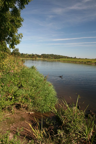
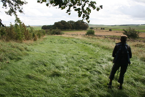
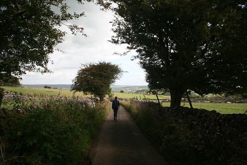
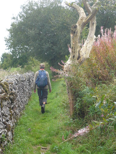
We managed to find a space in the small car park in the village and walked across the fields to Cross Lane. Natasha was deep in thought ...

Monyash Teashop Walk ~ 13th September 2009

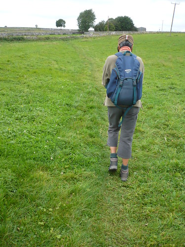
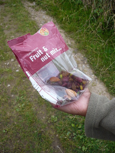
I don't think there was anything on her mind in particular, it was just one of those days. She soon picked up when we got out Sainsbury's Fruit & Nut Mix ...

Monyash Teashop Walk ~ 13th September 2009

We then walked over a mile along Huttmoor Butts [which always sounds like a porn star for some reason].~ I know, you're shocked.  

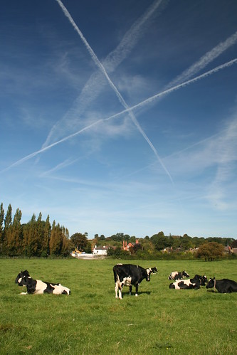
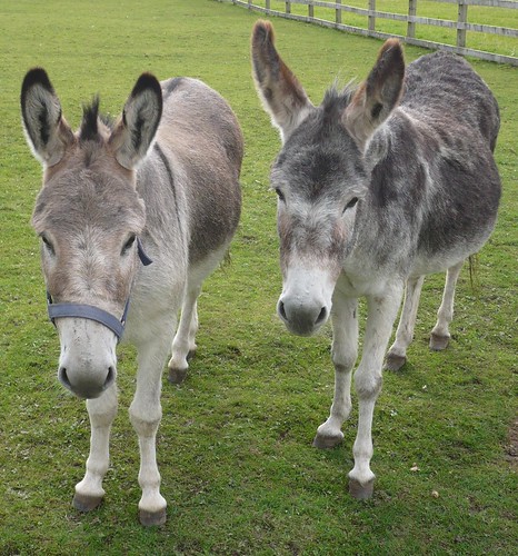
At the end of Huttmoor Butts, there's a donkey sanctuary at Newton Farm.

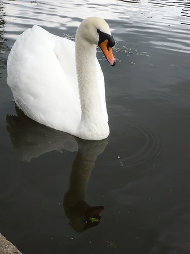
Even the donkeys seemed melancholy ...

Monyash Teashop Walk ~ 13th September 2009

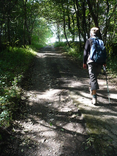
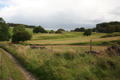
We crossed the A515 by the Bull i' th' Thorn and crossed the field towards the High Peak Trail, walking up the side of the Trail ...

Monyash Teashop Walk ~ 13th September 2009

We turned right with a view to walking towards the Duke of York on the A515. Beside the Trail a bull was having a scratch against a farmgate ... 

Monyash Teashop Walk ~ 13th September 2009

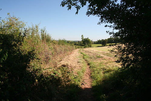
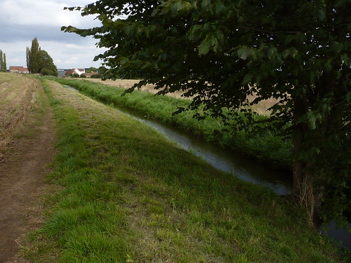
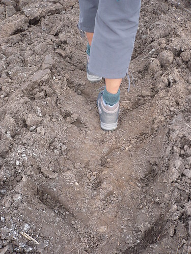
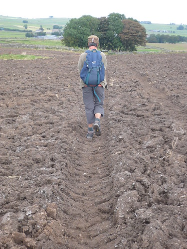
 We then crossed the A515 near the Duke of York, another pub 'under new management', and walked across the fields towards Flagg. The path in the field before Pasture Barn had been ploughed up but it was good to see the farmer had restored the path by running his tractor across the field.

Monyash Teashop Walk ~ 13th September 2009

Many people think it strange, or indeed wrong, to walk across a field with a crop though if it's a field of grass [which can be a crop] it's okay. What many people forget is that the path has probably been there a damn site longer than the field ... and this from a farmer's son !

Monyash Teashop Walk ~ 13th September 2009

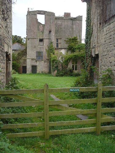
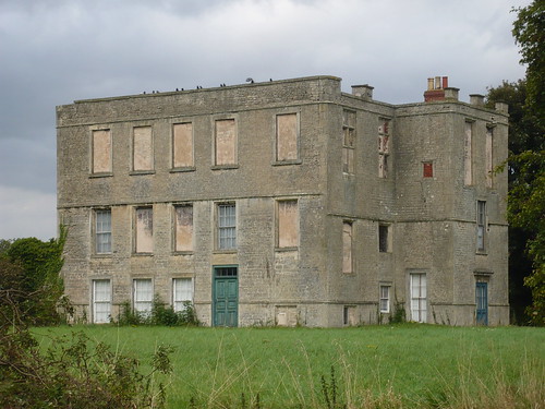
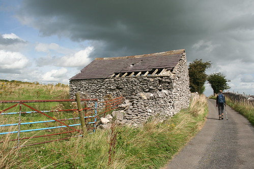
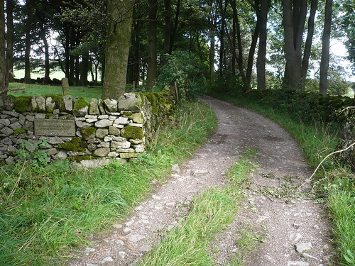
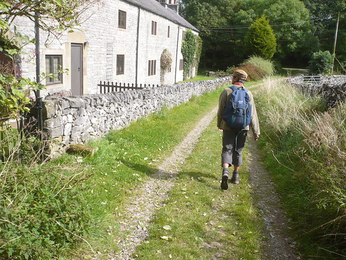
 No sooner had we reached Flagg than we turned right away from it following the Limestone Way back to Monyash. On the way we passed Dalehouse Farm ...

Monyash Teashop Walk ~ 13th September 2009

It seems likely that it has been a few years since this was a farm ... or perhaps I'm doing them a disservice.

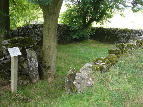
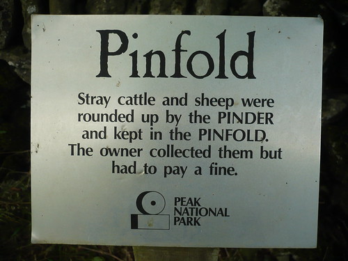
We turned right again, back along the road towards Monyash, passing the pinfold.

Monyash Teashop Walk ~ 13th September 2009

Monyash Teashop Walk ~ 13th September 2009

Then it was off to the Old Smithy for a cup of tea and a rather large and enjoyable bacon bap.

Date of walk ~ 13th September 2009


Length of walk ~ 5 1/2 miles.

Total since 1st September 2009 ~ 25 miles.

Tuesday 15 September 2009

Burton Joyce ...

Last Saturday I visited Burton Joyce on the outskirts of Nottingham hoping to plan a walk for the next book. I'd never been there in this lifetime and as a result I got lost ... on my way there and on my way back. I have no problems with Nottingham but I certainly didn't want to take in all its wonders just as Notts County's match against Northampton was finishing. 
I parked along Stoke Lane by the River Trent.

Burton Joyce and the Trent ~ 12th September 2009

 It was a glorious morning. The sun shone and it was really quite hot ....

Burton Joyce and the Trent ~ 12th September 2009

Walking into the cemetery adjoining St. Helen's Church I was looking for an unusual feature I'd read about .... and I had soon found it. The jawbone of a whale about eight or nine feet high ...

Burton Joyce and the Trent ~ 12th September 2009

A few yards away stands a poignant memorial to ayoung girl who died in her teens ...

Burton Joyce and the Trent ~ 12th September 2009

The church was open and I had a chat with a friendly woman who made me a cup of tea and told me something of the church and also about the young girl who had died.

After making a donation I walked along the main street of Burton Joyce and up Lambley Lane. A gradual climb brought me into the countryside ...

Burton Joyce and the Trent ~ 12th September 2009

At the top of the lane I turned right following a bridleway which passed between hedges ~ a feature that's always difficult to photograph ...

Burton Joyce and the Trent ~ 12th September 2009

 Hopefully, you get the idea.

The bridleway became a driveway linking a number of rather isolated proerties and as I walked beside one the sight of a couple of Rottweilers a few feet from me, the other side of a high, sturdy metal fence, had the hairs on the back of my neck standing up.

Eventually the last of these isolated homes was left behind and I was able to relax a bit as I got into the countryside.

Burton Joyce and the Trent ~ 12th September 2009

 Then I was walking down the hill towards the village of Bulcote. I sat under the trees in the grounds of Holy Trinity Church.

Burton Joyce and the Trent ~ 12th September 2009

Across the other side of the road is the bulk of the village and some of its attractive brick houses. The three below are named Ivy House, Ivyleaf House and Ivy Cottage ...

Burton Joyce and the Trent ~ 12th September 2009

A little further along the road, a marrow with writing on it ...

Burton Joyce and the Trent ~ 12th September 2009

I crossed the railway line and passed under the crackling electricity lines above me. The fields either side of the bridleway were planted with maize though in one area there were quite a few sunflowers. Most of their seed laden heads bowed down with the weight. Just one or two were still flowering ...

Burton Joyce and the Trent ~ 12th September 2009

  The next mile or so was spent following the riverside path back towards Burton Joyce.

Burton Joyce and the Trent ~ 12th September 2009

As I walked alongside the allotments I noticed that there were hops growing in the hedgerow. I picked one ~ it seemed to have quite a pleasant sharp smell. 

Burton Joyce and the Trent ~ 12th September 2009

 An enjoyable walk during which I saw no other 'real' walkers though I did see some fishermen, a few dogwalkers and a horserider.

Date of walk ~ 12th September 2009

Length of walk ~ 6 1/2 miles.


Total since 1st September 2009 ~ 19 1/2 miles.

Wednesday 9 September 2009

Walking through Rhodesia

I parked in the car park of the Lock Keeper in Worksop, with permission, and a rejoinder to the effect that I park there at my own risk ...


From Worksop ~ 5th September 2009


The Lock Keeper [as its name implies] stands right next to a lock on the Chesterfield Canal. Also next to the pub is bridge No. 41 ...


From Worksop ~ 5th September 2009


I walked westward and on the outskirts of Shireoaks passed under a low bridge ...


From Worksop ~ 5th September 2009


... just as a cyclist went past ....


From Worksop ~ 5th September 2009


Just beyond Shireoaks is probably some of the prettiest canal side walking I know and yet there never seem to be that many walkers about ...


From Worksop ~ 5th September 2009


. There were quite a few fishermen though, although they have to watch where they fish ...


From Worksop ~ 5th September 2009


At Turnerwood there's a double lock. I stood on the small bridge and watched this narrowboat pass through ...


From Worksop ~ 5th September 2009


... to appear on the other side in front of Turnerwood Cottages ...


From Worksop ~ 5th September 2009


The mute swans were friendly [though I didn't try to find out how friendly] ....


From Worksop ~ 5th September 2009


Anyone who has seen my blogs elsewhere will be aware of my unhealthy interest in memorials, especially quirky ones ...
From Worksop ~ 5th September 2009


At Turnerwood, in the last cottage on the right, you can get an ice cream, a coffee or a cup of tea most days. I opted for the ice cream, made locally ...
From Worksop ~ 5th September 2009


No sooner had I taken this photograph than I licked the ice cream off the cone ... but caught it in my right hand ... and stuck it back on again.


I left the canal at this stage and followed the canal feeder towards Brancliffe Grange ...


From Worksop ~ 5th September 2009


Nearer the grange the feeder splits and the water can be drunk by the horses in their paddock ...


From Worksop ~ 5th September 2009


The route I was following passed through a wood which seems to be Moses' Seat according to the OS Map ...

Then I crossed Monk Bridge before walking along the footpath across Lindrick Golf Club, looking out for stray golfballs ...


From Worksop ~ 5th September 2009


Just beyond Lindrick Dale on the way to Fan Field Farm there's an unusual feature on a house ...


From Worksop ~ 5th September 2009


The photograph could be better, I know ... but the garden is too overgrown !  Here's another stab at it ...


From Worksop ~ 5th September 2009


I crossed the railway line behind Fan Field Farm.


From Worksop ~ 5th September 2009


When I got back to the canal I was beyond Turnerwood and this time I walked eastward back towards Turnerwood itself. Then I headed southward across the field to Bottom Farm. After walking along the first part of Thorpe Lane, I had intended to use a field path to Shireoaks Park but it had been ploughed and, to be honest, I was starting to think I was running out of time, so I stayed on the road to reach the edge of Shireoaks itself. Here I turned sharp right  and reached The Hall ...


From Worksop ~ 5th September 2009


Now I know we have a heck of a lot of ancient buildings [or so it seems] but doesn't it seem a shame that this ancient hall is being left to deteriorate ...


From Worksop ~ 5th September 2009


Who owns it ?

Oh yes ... Rhodesia. Well it's a collection of houses on the outskirts of Worksop ...

It has its own roadsign though ...

.From Worksop ~ 5th September 2009


I took four hours on this seven mile walk, taking photographs as I went.

Date of walk ~ 5th September 2009


Length of walk ~ 7 miles.

Total since 1st September 2009 ~ 13 miles.

Sunday 6 September 2009

From Friden ...

After parking at Friden on the High Peak Trail we walked north along the road towards Middleton. Over the wall a dewpond [or was it a mere] glistened in the sunshine ...

From Friden ~ 1st September 2009.

We passed Long Dale and kept on along the road taking care on the roadbends. At the Middleton and Smerrill parish boundary we noticed this stone ...

 From Friden ~ 1st September 2009.

This is another of Middleton and Smerrill's Sites of Meaning ~ an excellent way to mark the Millennium.


Continuing along the road for another few hundred yards we climbed the stile and, avoiding the nettles, followed the path across Ringham Low. On reaching the unclassifed county road we turned right to climb to Kenslow Knoll on the 'out and back' path ...

From Friden ~ 1st September 2009.

There used to be an analemmatic sundial here but it seems to have either disappeared beneath the grass or been removed. There's a circuit path of the knoll and a viewfinder ... and there are some fine views. Perhaps one day the path will continue out the other side of Kenslow Knoll to link up with Long Dale or perhaps pass through the old sandpits to the south of Kenslow Knoll. At present we've got the views anyway ...

From Friden ~ 1st September 2009.

We came down from Kenslow Knoll and walked along Whitfield Lane towards Middleton ...

From Friden ~ 1st September 2009.

From Friden ~ 1st September 2009.

Whitfield Lane comes out just above Middleton and, as we were exploring, we turned uphill along Rake Lane. This is open to traffic though I don't recall seeing any cars as we walked the best part of a mile along it.


We crossed the road leading back to Friden and followed Green Lane past the entrance to Mere Farm. The tarmac surface gradually deteriorated until we were walking along a stony track ...

From Friden ~ 1st September 2009.

A single 4 x 4 came along. The driver was courteous and waved to us as we stood back.


We reached Green Lane Pits which is maintained by the Peak Park and which, I assume, is open to the public to explore [there's a stile just to the left of the gate] ...

From Friden ~ 1st September 2009.

I'm not quite sure what was extracted around here but as you can see on the opposite side of the field from the gate above, the ground has been knocked about a bit ...

From Friden ~ 1st September 2009.

Green Lane then crosses the line of a Roman road which runs straight across the lane below. As far as I know there are no signs of this ancient road on the ground.

From Friden ~ 1st September 2009.

In the wall above there's another of the Sites of Meaning. All I need now is a translation ...

From Friden ~ 1st September 2009.

Then it was just a case of joining the High Peak Trail and walking back to the car.

Date of walk ~ 1st September 2009

Length of walk ~ 6 miles.