Wednesday 28 July 2010

Finishing off Offa's walk ... Day 1

Sunday, the 18th April 2010, and we were back in Wales, hoping to complete my journey along the Offa's Dyke Path.


We had a problem though as I thought I'd finished last time a bit further north than I had done. So half an hour was spent getting to the right starting place.

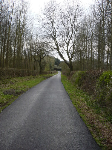
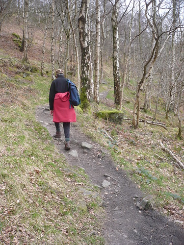
We were soon rising up the path leading to Moel Famau [pronounced, I believe, Moil Vamow] ~ feel free to correct me if you know better.


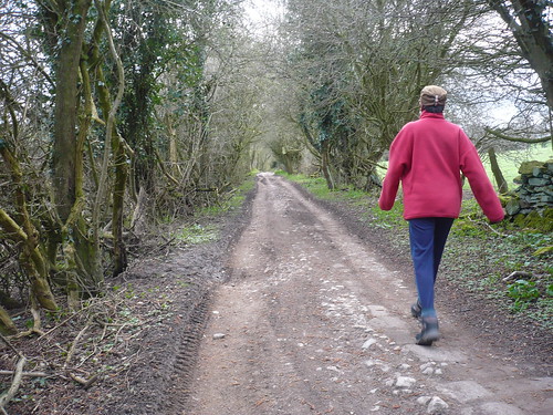
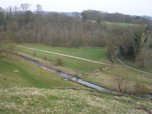
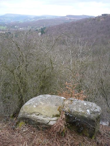
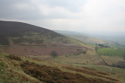
Looking back the hills stretched away into the distance ... hills I had walked some time ago ...


Finishing the Offa's Dyke Path ~ April 2010


Being a Sunday there were quite a few people walking up Moel Famau, some in flat shoes which weren't the most appropriate things to wear.


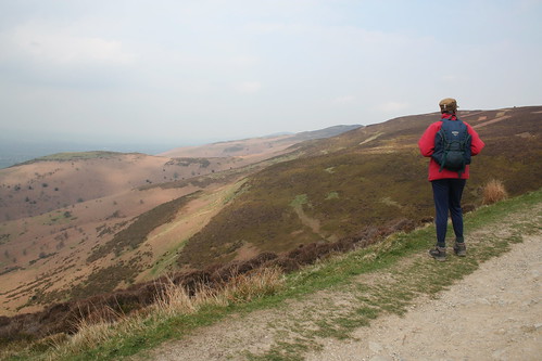
We stopped to admire the view and catch our breath ...

Finishing the Offa's Dyke Path ~ April 2010

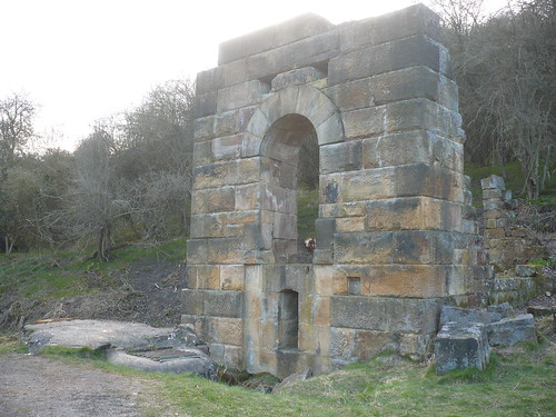
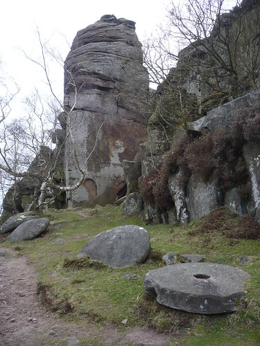
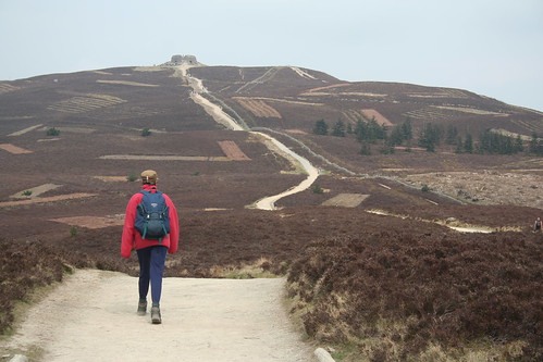
Having caught our breath we pressed on ... towards the remains of the Jubilee Tower atop Moel Famau ...

Finishing the Offa's Dyke Path ~ April 2010


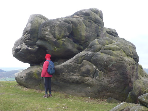
Once upon a time the tower, which was built to mark the golden jubilee of George III, stood 150 feet high until a storm reduced it somewhat. There's an interesting video clip here and, despite an idiosyncracy or two, it's worth watching ... http://www.youtube.com/watch?v=twgYM2WhCIs ... [there's a bit of a surprise at the end so bear with it].


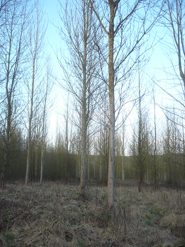
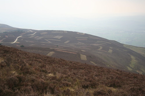
The path leads to Moel Dywyll and as we went we noticed how strips of heather had been cleared on the hillside ....

Finishing the Offa's Dyke Path ~ April 2010


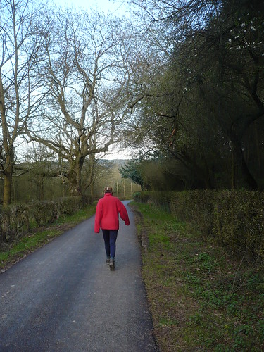
... and, looking back, a last glimpse of the ruins of Jubilee Tower ...

Finishing the Offa's Dyke Path ~ April 2010

In fact we were to see Jubilee Tower for at least another two or three days but we didn't know that then.


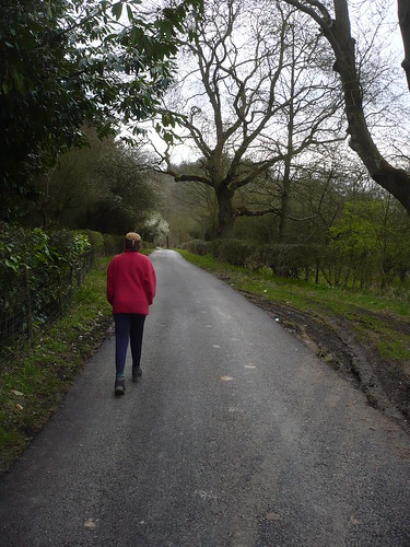
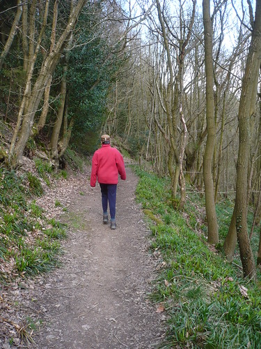
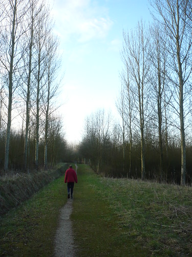
As we got further from the car park, we got further from the crowd ...

Finishing the Offa's Dyke Path ~ April 2010


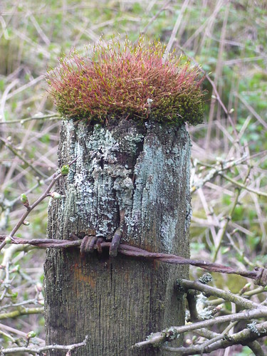
There had been very little sun and as the wind got up we sat on a couple of stones on the leeside of a wall ... and had a coffee whilst admiring the rusting ironwork nearby.

Finishing the Offa's Dyke Path ~ April 2010


It was originally part of the barbed wire fence.


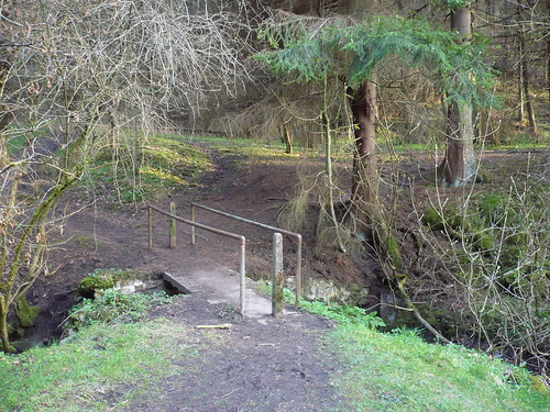
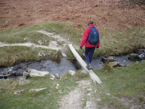
At this point we had started to think about getting back to the car park so we took a bridleway running across the lower slopes of Moel Dywyll and started to descend ...

Finishing the Offa's Dyke Path ~ April 2010

Finishing the Offa's Dyke Path ~ April 2010


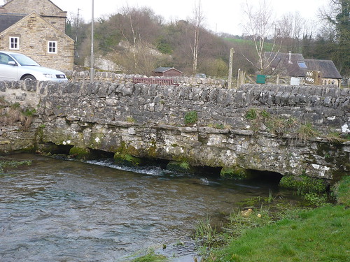
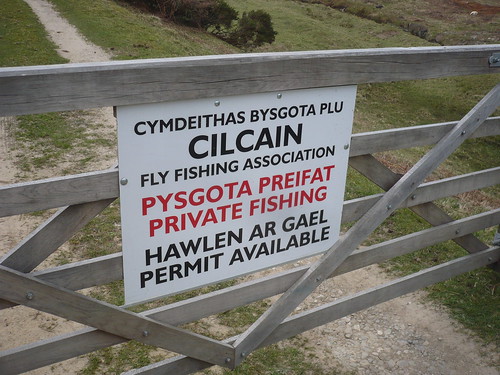
We passed a small reservoir with a single fisherman trying his luck ...

Finishing the Offa's Dyke Path ~ April 2010


Presumably he was a member of the Cilcain Fly Fishing Association ...

Finishing the Offa's Dyke Path ~ April 2010


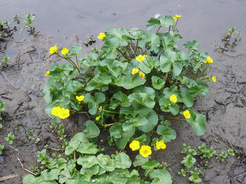
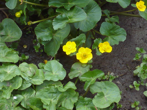
We followed Bridleway No. 69 in the parish of Cilcain, admiring the daffodils as we went. Somebody had been busy.

Finishing the Offa's Dyke Path ~ April 2010


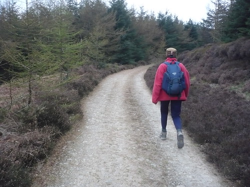
Another bridleway started us on the climb back up the hill towards the car park, still some miles away ...

Finishing the Offa's Dyke Path ~ April 2010


It was round about this point that time became more of a consideration. We'd noticed that the car park closed at 6pm and we obviously didn't want to get locked in.


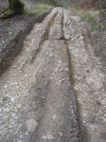
We took one of the forestry tracks, relying on them to get us to the car park sooner rather than later.

Finishing the Offa's Dyke Path ~ April 2010


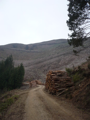
Now I would have thought at some point or another there might be a map showing just where these forestry tracks lead you ... there wasn't.


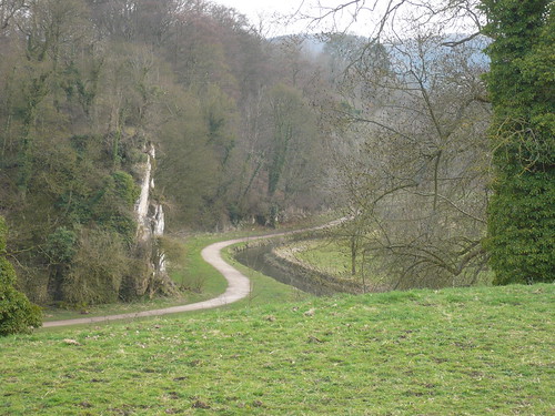
We wound into and out of three side valleys below Moel Famau.


Time was passing ...


Our walking speed picked up ...

Finishing the Offa's Dyke Path ~ April 2010


As we finally neared the car park [and after some ten miles] I broke into a run ... with a heavyish rucksack on my back ... and got there with four minutes to spare ...

Finishing the Offa's Dyke Path ~ April 2010


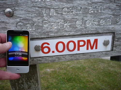
... only to find that the car park isn't locked up at 6pm at all ... or at least not until much later.


Still, it made for an exciting end to the walk. Would we recover enough for the next day though ?

Date of walk ~ 18th April 2010

Length of walk ~ 10 miles

Total walked so far in 2010 ~ 75.75 miles

Total walked since 1st September 2009 ~ 205.75 miles

16 of 2010

Friday 23 July 2010

Across the river ...

We'd had one of those days where we'd not really nothing anything ... so in the evening we drove across to the other side of the river and parked near Enthovens and walked up Oldfield Lane ...

South Darley ~ 11th April 2010

The first thing that struck me is that someone has actually surfaced what was a roughish piece of track. Now who would have done that and why ?

South Darley ~ 11th April 2010

The only people I could think of would be the owners of Sabine Hay. After all they have to drive up Oldfield Lane every day presumably.

At the side of the lane I noticed this moss growing out of the top of a fencepost ...

South Darley ~ 11th April 2010

 Eeeh, we were that poor we 'ad t'live in 'top o' a fencepost ...

It was almost reassuring to see that Oldfield Lane reverted to its original state just past Cowley Knoll, where the drive to Sabine Hay leaves it. I say 'almost' though I think the 'One Life, Live It' brigade have made a heck of a mess of the old road ...

South Darley ~ 11th April 2010

 I wonder how the bikers and mountain bikers get on coming down this stretch ?

Beyond Cowley Knoll, where it's a bit flatter, the old lane is much nicer to walk ...

South Darley ~ 11th April 2010

South Darley ~ 11th April 2010

Natasha hadn't bothered to take her rucksack, it was that much of a stroll ...

A little further along we turned sharp right along the footpath that drops back into Clough Wood. Try and walk it just as the light begins to fade. Sometimes you can see the deer starting to move around in the trees ...

South Darley ~ 11th April 2010

Not this evening though ... we were too early.

Eventually you reach the remains of Millclose Mine.

South Darley ~ 11th April 2010

At one time over two hundred men used to work here and it was stll being mined in the 1930s. In other articles, I have read that at one time over eight hundred men were employed there.

It was also, apparently, the largest leadmine in the district ! The UK ! Europe ! The World ! Who knows ... it must have been pretty big.   

You can see the main shaft better in this next photo ...

South Darley ~ 11th April 2010

It's been capped [not surprisingly] ...

So then we were walking back down Oldfield Lane.

South Darley ~ 11th April 2010

 We turned to the right into the trees that stand on land belonging to Enthovens. I remember this area when it was fields, owned by my Uncle Bill who had a farm at Darley Bridge. He had cattle and there was a suggestion that some of them died from lead poisoning as a result of the 'fallout' from the lead smelting at Enthovens. 

They bought him out ... and now there are loads of poplars planted on the ground.  

South Darley ~ 11th April 2010

We wandered around. A fox ran across the path. Deer started stirring. The sun was setting, its light slanting through the trees ...

South Darley ~ 11th April 2010

In the failing light we headed back to the car ...

South Darley ~ 11th April 2010

 Date of walk ~ 11th April 2010

Length of walk ~ 2.75 miles

Total walked so far in 2010 ~ 65.75 miles

Total walked since 1st September 2009 ~ 195.75 miles

15 of 2010

Sunday 18 July 2010

Around Bradford Dale ...

Another short walk, this time from the layby at the side of the Youlgreave road, Alport.

This time we followed a path on the western side of the River Bradford towards Bradford village.

Bradford Dale ~ 10th April 2010

It's strange but, I think, the photgraph above cries out for a couple in Victorian dress walking away from the camera. Whether it's because the path looks like a lot of path used to look like in Victorian photos, namely surfaced and/or well walked, I don't know ...

Bradford Dale ~ 10th April 2010

Bradford Dale ~ 10th April 2010

Once we'd got down to the bridge at Bradford ...

Bradford Dale ~ 10th April 2010

... we crossed over to the other side of the river and took the less popular path on that side. I always try and take the path less travelled ...

We looked back to the bridge and the cottages there. Bradford is part of the village of Youlgreave. 

Bradford Dale ~ 10th April 2010

It was just after this that I took my first photo with my new HTC phone. I had rather hoped it would be able to take and send good quality photos ~ it doesn't. Ain't life crap in that respect sometimes ? 

Anyway, we walked on across the fields towards the south-western end of Bradford Dale ...

Bradford Dale ~ 10th April 2010

We stopped at one of Middleton's Sites of Meaning, by the clapper bridge over the river at the top end of Bradford Dale, enjoying the peace and quiet.

Then we carried on into the dale, descending some rather unusual steps for a country walk ...

Bradford Dale ~ 10th April 2010

Natasha was off ...

Bradford Dale ~ 10th April 2010

... crossing the small spring, which you can see just ahead of her in the photo above. The water was so clear ...

Bradford Dale ~ 10th April 2010

Bradford Dale was largely deserted. Once again we'd come out when most walkers were heading home ... 

Bradford Dale ~ 10th April 2010

Although it was springtime there was little sign of colour and new life ... until we came to a clump of marsh marigolds [or perhaps it was just a clump that I could get near enough to photograph] ...

Bradford Dale ~ 10th April 2010

Bradford Dale ~ 10th April 2010

After that we kept on down the dale, looking out for fish in the river and just enjoying the sounds of running water.

Unfortunately my camera at this point must have decided to only take dark photographs [obviously it was the camera's fault] and so I have no others left to include.

I tell a lie. After the walk we made our first visit of the year to the Devonshire Arms at Beeley. It may have taken itself out of our list of Favourite Pubs but it still rates high on our list of Pubs That We Love Sitting Outside Whilst Eating Crisps And Having A Pint Of Old Peculier.

Here's the proof ...

Bradford Dale ~ 10th April 2010

Aaah ....

Date of walk ~ 10th April 2010

Length of walk ~ 3 1/2 miles [I know ... pathetic]

Total walked since 1st September 2009 ~ 193 miles

14 of 2010

Monday 12 July 2010

Froggatt and Grindleford

We started from the National Trust's Hay Wood car park and followed the path along Froggatt Edge. It was rather a dull, cloudy day ...

Froggatt and Froggatt Edge ~ 6th April 2010

... and there weren't many walkers about.

Froggatt and Froggatt Edge ~ 6th April 2010

Some of the gritstone boulders up there are really intriguing ...

Froggatt and Froggatt Edge ~ 6th April 2010

A mile or so along this path another path cuts back sharply to the right, below the Edge. Here discarded and unfinished millstones lie around on the ground ...

Froggatt and Froggatt Edge ~ 6th April 2010

We walked down the hill into the village of Froggatt and walked along Spooner Lane. Beside the lane there were these fresh green leaves starting to push through ...

 Froggatt and Froggatt Edge ~ 6th April 2010

Spring was only just starting to make its presence felt and looking back [from July] everything looks so bare.

Froggatt and Froggatt Edge ~ 6th April 2010

 The wood betwee Froggatt and Grindleford is delightful at any time of the year.

Froggatt and Froggatt Edge ~ 6th April 2010

There's a pond part way through the wood and, somewhere, I have a slide showing me swinging across the pond ... no, really.

Froggatt and Froggatt Edge ~ 6th April 2010

Shortly after this we took a path that rose up the hillside to see where it went ...

Froggatt and Froggatt Edge ~ 6th April 2010

... it dropped back downhill to join up with the path we had left ten or fiteen minutes later.

We reached the Peak and Northern signpost at Grindleford Bridge.

Froggatt and Froggatt Edge ~ 6th April 2010

We were on the way back by now and turned eastward, uphill, towards Hay Wood car park. On the way up the hill another signpost gave us an option to go one way ... or the other ...

Froggatt and Froggatt Edge ~ 6th April 2010

The climb up the hill continued though I don't think it was quite as bad as this photograph might suggest ...

Froggatt and Froggatt Edge ~ 6th April 2010

 Date of walk ~ 6th April 2010

Length of walk ~ 4 miles

Total walked so far in 2010 ~ 59 1/2 miles

Total walked since 1st September 2009 ~ 189 1/2 miles

13 of 2010