The public toilet in the Visitor Centre at Laxton, Nottinghamshire, has a shower in it ...
Whether it is available for the public to use I don't know, but it's there, in the corner.
Walking down the side of the Dovecote Inn, between the inn and the Visitor Centre, you reach the village green ...

Just beyond the churchyard I turned right, along this bridleway. Looking back you get some idea of the mud on it. Still, it's used by agricutural vehicles ~ it's a working environment.

A few hundred yards later I turned left along Hall [or Back] Lane ...

Twenty minutes or so later and I was walking across Mill Field where the majority of the old field strips can be seen. I reached a crossroads of paths ...

It's quite an open landscape around here with just the odd tree here and there and the occasional copse. Sometimes a larger tree grows in a hedgerow as can be seen here on Mill Lane ...

I climbed a small hill and turned sharp left across a recently sown field. The farmer had restored the path which was good to see.

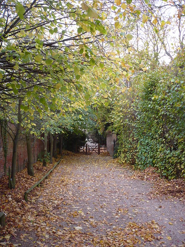
A few paths later and I was walking eastwards along an avenue of trees as the showery rain dripped through them.

At the far end of the trees I passed through a farmgate and came to a really mud field. Near the gate the cows had created these 'furrows' from constant use ...

Back in the village I sat on a seat in the churchyard drinking my coffee and eating my chocolate bar [with added nuts and stuff]. The church wasn't open ...

A couple of gravestones caught my eye ...


Then it was back out onto the main street. Most of Laxton seems to be owned by the Crown Estate. All the farms have their names uniformly marked in blue on a silver background ...

... except for Mr. Grundy and Mrs. Freer ...

I finished the walk with a pint and a bit of a slap-up meal in the Dovecote. Good to see it was reasonably busy at lunchtime during the week.
Date of walk ~ 22nd October 2009
Length of walk ~ 5 1/2 miles.
Total since 1st September 2009 ~ 74 1/4 miles
Walking down the side of the Dovecote Inn, between the inn and the Visitor Centre, you reach the village green ...

Just beyond the churchyard I turned right, along this bridleway. Looking back you get some idea of the mud on it. Still, it's used by agricutural vehicles ~ it's a working environment.

A few hundred yards later I turned left along Hall [or Back] Lane ...

Twenty minutes or so later and I was walking across Mill Field where the majority of the old field strips can be seen. I reached a crossroads of paths ...

It's quite an open landscape around here with just the odd tree here and there and the occasional copse. Sometimes a larger tree grows in a hedgerow as can be seen here on Mill Lane ...

I climbed a small hill and turned sharp left across a recently sown field. The farmer had restored the path which was good to see.

A few paths later and I was walking eastwards along an avenue of trees as the showery rain dripped through them.

At the far end of the trees I passed through a farmgate and came to a really mud field. Near the gate the cows had created these 'furrows' from constant use ...

Back in the village I sat on a seat in the churchyard drinking my coffee and eating my chocolate bar [with added nuts and stuff]. The church wasn't open ...

A couple of gravestones caught my eye ...


Then it was back out onto the main street. Most of Laxton seems to be owned by the Crown Estate. All the farms have their names uniformly marked in blue on a silver background ...

... except for Mr. Grundy and Mrs. Freer ...

I finished the walk with a pint and a bit of a slap-up meal in the Dovecote. Good to see it was reasonably busy at lunchtime during the week.
Date of walk ~ 22nd October 2009
Length of walk ~ 5 1/2 miles.
Total since 1st September 2009 ~ 74 1/4 miles


