Thursday 31 October 2013

Giddy Edge, High Tor and Matlock Bath ...

Most of the buildings of Matlock lie on the northern side of the River Derwent. On the southern side Masson Hill rises high up the town ...


Matlock and Giddy Edge ~ May 2011

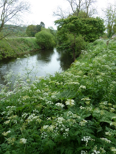
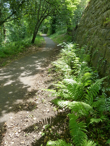
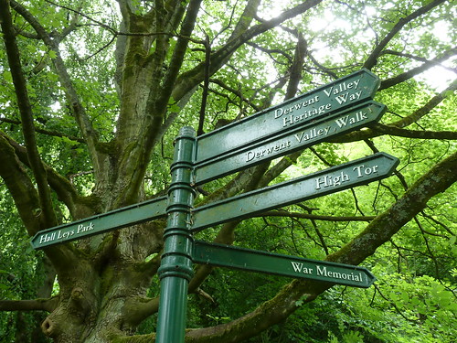
 The Derwent Valley Heritage Way follows a riverside path into the town ...

Matlock and Giddy Edge ~ May 2011

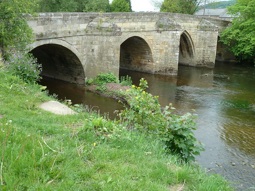
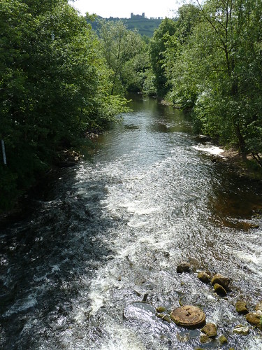
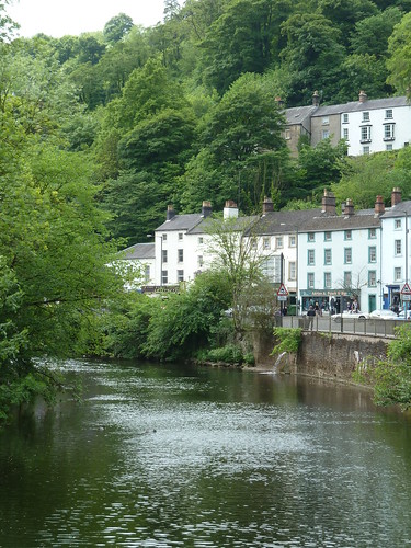
From the old stone bridge crossing the Derwent look downstream and you will see 19th century Riber Castle rising high above the town ...

Matlock and Giddy Edge ~ May 2011

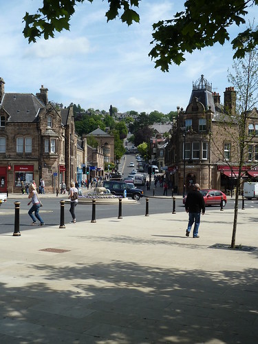
 Turn to your left at this point and you get a view of Bank Road rising up from Crown Square. In the late 19th and early 20th centuries a tramway ran up the hill and down again, taking visitors to and from the hydros on the hillside ...

Matlock and Giddy Edge ~ May 2011

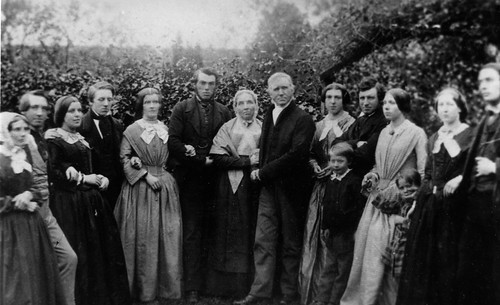
 A walk alongside the River Derwent brings you to Knowleston Place with some of the earliest dated houses in the town ...

Matlock and Giddy Edge ~ May 2011

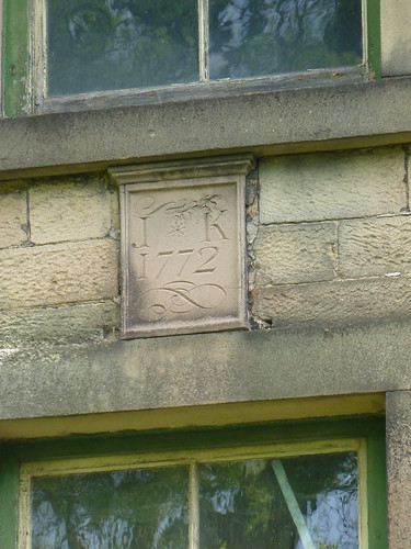
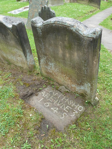
 The property above is now an outhouse ... with a very fine date stone.

Keep left beside the river from Knowleston Place and follow the riverside path ...

Matlock and Giddy Edge ~ May 2011

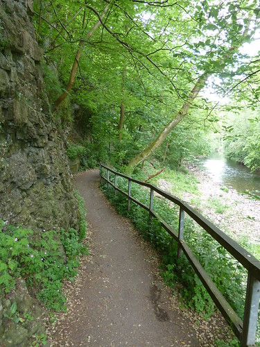
 This soon brings you to the bottom of Pic Tor ...

Matlock and Giddy Edge ~ May 2011

 Verious path options present themselves ...

Matlock and Giddy Edge ~ May 2011  

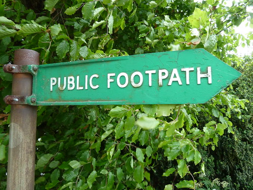
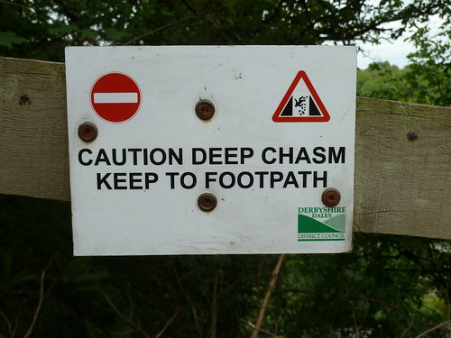
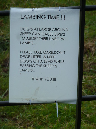
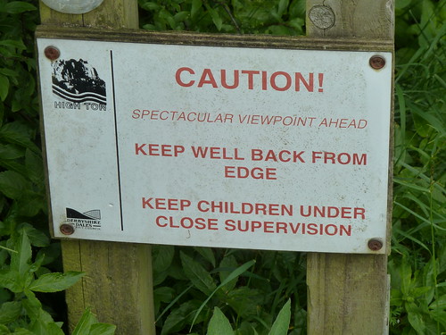
One day a couple of years ago I decided to follow the path up to High Tor ... and there were plenty of warnings to keep to the path ...


Matlock and Giddy Edge ~ May 2011  

Another sign shortly afterwards wasn't quite so professional ...

Matlock and Giddy Edge ~ May 2011  

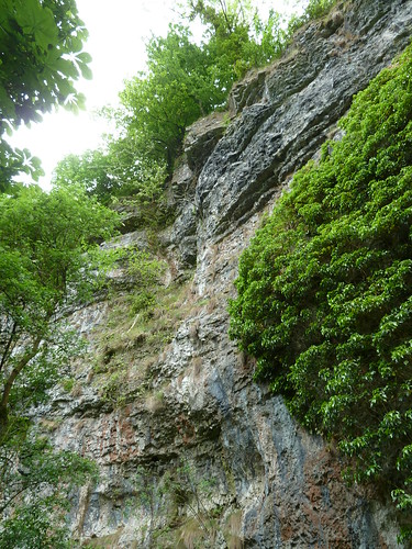
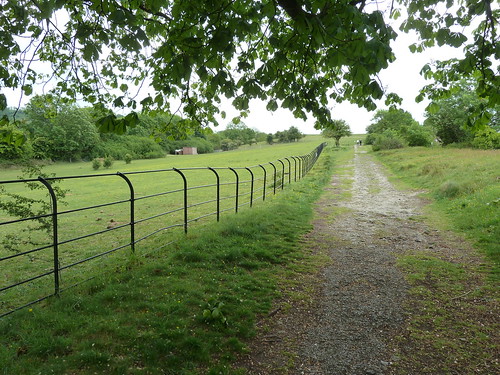
The path ran alongside a fence on the left with a big drop [out of sight] on the right ...

Matlock and Giddy Edge ~ May 2011  

On reaching High Tor there's a great view looking back towards Matlock in the distance ...

Matlock and Giddy Edge ~ May 2011  

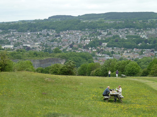
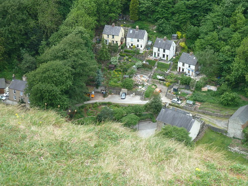
In between there's the big drop down to the A6 and the surrounding houses of course.

Matlock and Giddy Edge ~ May 2011  

Another warning sign !

Matlock and Giddy Edge ~ May 2011  

The spectacular viewpoint is, of course, High Tor which rises high above the River Derwent. Just beyond the tor is a path leading down to Giddy Edge ...

Matlock and Giddy Edge ~ May 2011  

A thin metal handrail attached to the limestone on your left is all you have to hold on to as you walk above the river and the A6 one hundred yards or so below. I have a noisy video of the path which I will not inflict upon you.

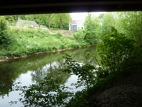
Eventually I zig-zagged down to Matlock Bath and the Derwent ...


Matlock and Giddy Edge ~ May 2011  

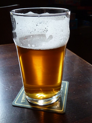
I called in at the Princess Victoria for a pint ...

Matlock and Giddy Edge ~ May 2011  

Adequately refreshed I then climbed back out of the valley ...

Matlock and Giddy Edge ~ May 2011  

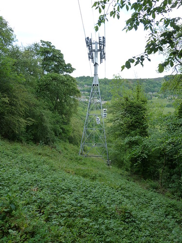
As I picked my way along a narrow woodland path the cable car rising to the Heights of Abraham passed overhead ...

Matlock and Giddy Edge ~ May 2011  

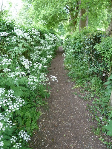
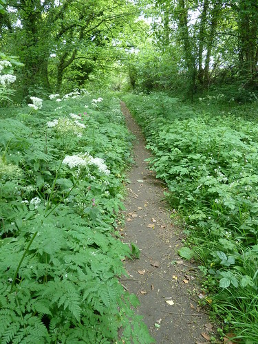
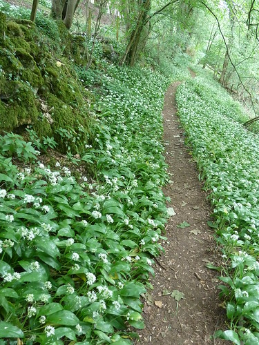
I was now well away from the noise coming from Matlock Bath and its visitors ...

Matlock and Giddy Edge ~ May 2011  

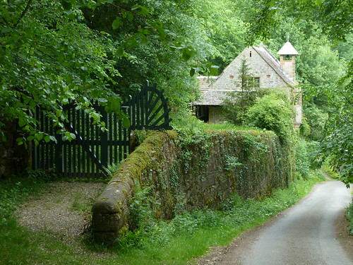
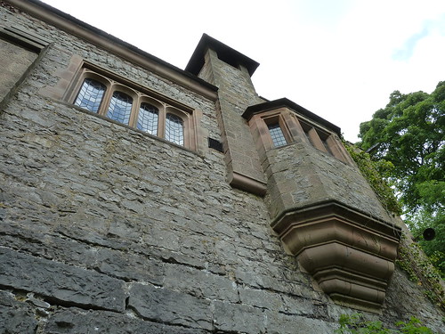
Tucked away in the woods above Artists' Corner between Matlock and Matlock Bath is St. John's Chapel. Most of the visitors to the area probably won't be aware of its existence. Indeed without some help from Friends of Friendless Churches the chapel might have fallen into disrepair by now ...

Matlock and Giddy Edge ~ May 2011  

Matlock and Giddy Edge ~ May 2011  

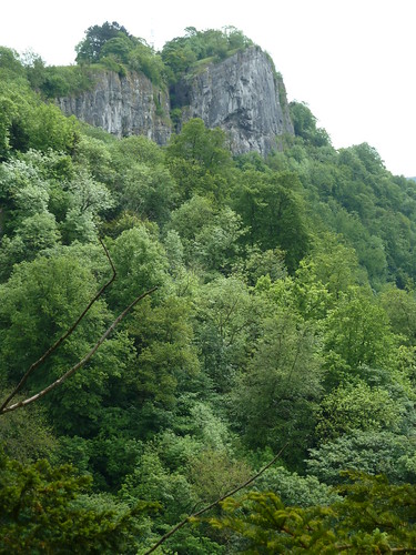
Through a gap in the trees I was able to glimpse High Tor across the valley ...

Matlock and Giddy Edge ~ May 2011  

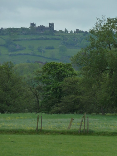
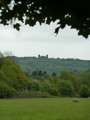
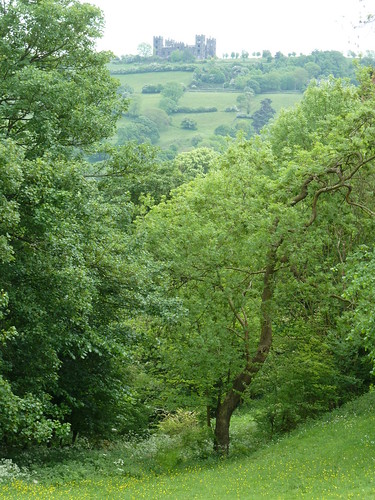
A hundred yards or so later Riber Castle was visible ...

Matlock and Giddy Edge ~ May 2011  

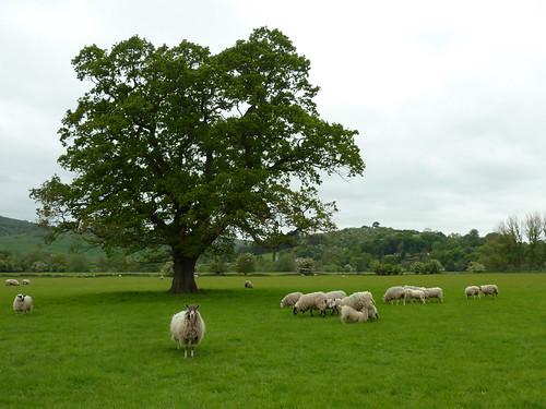
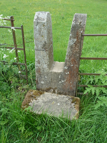
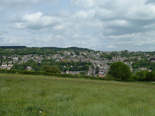
As I walked across the field, back towards Matlock, I reflected upon a walk full of marvellous scenery ...


Matlock and Giddy Edge ~ May 2011  

This walk was followed on the 21st May 2011
 
Length of walk ~ 4.73 miles *
 
Total mileage walked so far in 2011 ~ 196.16 miles
 
Total mileage between the 1st September 2009 and the 21st May 2011 ~ 717.90 miles

  43 of 2011 [which means in 2011 I was still averaging just over 4.5 miles a walk.]
 
* distance calculated on Ordnance Survey's Getamap

A Farm Journal ~ from the 2nd to the 16th May 1870

My great great great uncle John Bayliff Bowman lived at Summer Hill, near Monyash in the County of Derby, until the end of January 1870 when he moved to Sandycroft Farm, Queensferry, Flintshire.

The Bowman family, who were Quakers, had rented three farms, One Ash Grange [which John Bayliff Bowman often referred to as O.A.], Cales and Summer Hill [which he usually referred to as S.Hill or S.H.]

John Bayliff Bowman is fourth from the left in the photo below ...

The Bowman family

 A Farm Journal continues :~
 
No entry for the 1st May 1870.
 
2 - 2nd 5 Mo[nth] Fine dry lead man[ur]e to No 12 for Cabbage etc
 
3 Ditto - Griffiths sale at Rake - had tea & toasts in even[in]g
 
4 & 5 spreadman etc
 
6 planted Cabbage - 4 men & 2 women planted ab[ou]t 2 ac[res] masons doing fire place self to Chester for pump & pipes
 
7 Fine N.N.W. fin[ishe]d plant[in]g cabbage - pick[e]d scutch - sow[e]d rem[ainde]r of No 12 with swedes - fallow[in]g etc men doing fire place - Swedes & Mangolds 1st lot sown have been in gr[oun]d 3 1/2 weeks & are not much up
 
2 - 9 Very hot day - sow[in]g man[ur]e on Stacky[ar]d f[iel]d for swedes & fallow[in]g - borrow[e]d water cart from Wright of Copt farm to water cabbage plants gr[oun]d very dry when planted - should have put them in soil & watered & Kept till rain came - many small plants
 
3 - 10 Fine & hot sow[e]d swedes etc
 
4 - 11 Showery day W.S.E. - very acceptable - Masons finish[e]d fire place
 
5 - 12 Ditto F & I took drive out
 
6 - 13 Fine day two women picking turnip stalks off wheat & spudding thistles - fallow[in]g
 
7 - 14 Ditto 
 
1st Showery
 
2 - 16 Fine - Horse hoeing beans etc. 


I assume 'No 12' relates to a field. Were some of the fields numbered ?
  

Tuesday 29 October 2013

A Farm Journal ~ from the 23rd to the 30th April 1870

My great great great uncle John Bayliff Bowman lived at Summer Hill, near Monyash in the County of Derby, until the end of January 1870 when he moved to Sandycroft Farm, Queensferry, Flintshire.

The Bowman family, who were Quakers, had rented three farms, One Ash Grange [which John Bayliff Bowman often referred to as O.A.], Cales and Summer Hill [which he usually referred to as S.Hill or S.H.]

John Bayliff Bowman is fourth from the left in the photo below ...

The Bowman family

 A Farm Journal continues :~

7 - 23 Fine weather no rain - have 5 Irish & Will[ia]m Davis extra for potato setting

1 - 24 F & M S & I to Meet[in]g

2 - 25 Fine waiting of potato sets - was disappointed by Davis of Hawarden about a truck of Scotch Down sets - so had to see out for some - men forking twitch from among beans

3 - 26 Fine carts to Argoed near Mold for some Skerry blue sets of John Griffiths @ 3/- p[e]r 90 lbs & across to the sands for some Scotch downs @ 3/-

4 - 27 Fine but desperate windy & dusty - setting potatoes - 2 teams gone to work for old Rector Davis - another load of Scotch down sets from Jos[eph] S. Windley - fin[ishe]d setting my potatoes the men have theirs to set in morn[in]g - 4 rows each to 3 plough men & Wright 2 ea[ch] to Jimmy - Rob[er]t & John Jones & Edward - working stackyard for swedes - turning manure in yards - Joiner E.Davis & son making some sheep troughs & made & put up new hatch gate for end of bank

5 - 28 fin[ished] potatoes - work[in]g rem[ainde]r for cabbage 

up to 7 day 30th Fine but dry - bro[ugh]t mare of Beckett of Peel Hall home from Chester & left the old mare with Jones & Gerrards 

Monday 28 October 2013

A Farm Journal ~ from the 1st to the 22nd April 1870

My great great great uncle John Bayliff Bowman lived at Summer Hill, near Monyash in the County of Derby, until the end of January 1870 when he moved to Sandycroft Farm, Queensferry, Flintshire.

The Bowman family, who were Quakers, had rented three farms, One Ash Grange [which John Bayliff Bowman often referred to as O.A.], Cales and Summer Hill [which he usually referred to as S.Hill or S.H.]

John Bayliff Bowman is fourth from the left in the photo below ...

The Bowman family

 A Farm Journal continues :~

6 - 1st 4 Mo[nth] sow[e]d small seeds on wheat & roll[e]d etc

7 - 2 Ditto Ditto - very backward weather for vegetation - lints sown a month ago not up yet

1 - 3 Fine

2 - 4 Ditto to 4 - 6 Ditto 25 Hogs from Derbyshire arr[ive]d safely work[in]g 14 ac[res] for mangolds - old chopper broke cogs bo[ugh]t another at  Chester

5 - 7 Fine

6 - 8 Showery even[in]g

7 - 9 Wet & showery got new chopper to work lead[in]g manure onto ridges for mangolds

1 - 10 Showery

2 - 11 Fine lead[in]g manure for mangolds & spread[in]g up to Alletsons to call with Sarah & children bo[ugh]t some Flowerpots - looked over the works 

3 - 12 & 13 sow[in]g mangolds & work[in]g etc

5 - 14 Beautiful day self to Rhyl & to Bodrydden [sic] Hall sale of Stock but did not stay it as there was nothing in my way an old fashioned place in Vale of Clowyn [sic] - very nice land mostly grass - Nurse Bean came in even[in]g

6 - 15 Good Friday Men off today mason from Hawarden lowering fire grate under Engine boiler & put longer bars in

7 - 16 Misty morn[in]g Co[u]s[in] E[liza] & I to Ashford

1 - 17 Fine day

2 - 18 Ditto B[akewe]ll Fair Strong fair had my cheese down etc. sold part to John Thomas Crewe 65/- & rem[ainde]r to Jos[eph] B[owman] B[loore] @ 62/6 - Cattle dear but easier sheep lower

3 - 19 Ditto Father & Mother & self started 10-19 for Chester by M[an]chester - arr[ived] 2.10 found all well

4 - 20 Ditto cutt[in]g potatoes & setting muck out on No 12-5-21 Ditto Chester Fair took in calf Heifer & sold £13 5/- also Bay filly but not sold - good many beasts in but few well bred some nice yearl[in]g Irish £5 sturks £9

622 [sic] dull showery even[in]g set[tin]g potatoes 

Sunday 27 October 2013

In the Derwent Valley ... not a recent walk !

Before anyone thinks I've been walking over five miles in the last few weeks please let me disillusion you as this walk took place over two years ago.

I walked from my home in Darley Dale towards St. Helen's Church and got as far as the Peak Rail signal box on Church Road ...

P1040544

 Notice anything unusual about this feature ?

In the churchyard a few hundred yards later this 17th century stone had recently been cleaned up by the look of it ...

P1040545

Follow the Derwent Valley Heritage Way to this substantial stile between the church and Darley Bridge ...

P1040548  

This footpath signpost was cleaned up and painted by a couple of local footpath workers when they worked on the Derwent Valley Heritage Way with the County Council. One of them was Joe Clark who lives in Darley Dale ...


P1040551  

It's the local cricket club's 150th birthday this year. I wonder how many other village clubs are that old ?

P1040552  

The River Derwent passes under the centuries old bridge at Darley Bridge ...

P1040554  

I followed the river downstream on the far side of the bridge ....

P1040562  

It was good to see the allotments well used at Wenslees.

P1040564

I was now in the valley bottom and further on down the valley, beyond Matlock, Riber Hill was clearly visible ... albeit by using a zoom lens.

P1040566

 I took a path on my left in the village of Oker [Oaker if you prefer] ...

P1040570

 I walked beside the river until I reached the railway bridge on the edge of Matlock ...

P1040578  

I didn't pass under it though to follow the river into Matlock. I took the concessionary path across it and headed back into Darley Dale ...

P1040581

 Although it may not look it, it is fenced off.

I followed the path into the fields between the railway line and the river ...

P1040583  

I turned round and took a similar photograph to the one I took earlier of Riber Castle ...

P1040588

I rather liked this squeezer stile in one of the subsequent fields ...

P1040590  

There was plenty of sweet cicely beside the path ...

P1040595  

I discovered in the trees near the Red House that I'd never actually followed the proper line of the path. I couldn't this particular day either as the footbridge had been swept away ...

P1040596  

Perhaps someone can tell me what this sign beside the old railway line represents ...

P1040598  

I took the footpath beside the Red House Hotel to reach The Promenade ...

P1040600  

As I wandered back home it was good to see that the boating lake in the Whitworth Park had been restored and refilled with water ... though not for boating ...

P1040601  

 This walk was followed on the 16th May 2011
 
Length of walk ~ 5.48 miles *
 
Total mileage walked so far in 2011 ~ 191.43 miles
 
Total mileage between the 1st September 2009 and the 16th May 2011 ~ 713.17 miles

  42 of 2011 [which means in 2011 I was still averaging just over 4.5 miles a walk.]
 
* distance calculated on Ordnance Survey's Getamap